Possible MH370 debris sighting off coast of Sumatra
Last Updated Mar. 16 th. 2024
Here are some photos of possible photographic evidence of wreckage of MH370 off the coast of Sumatra.
 |
Click on this link to see how debris would have drifted from this debris field location towards Africa: Sumatra Forward drift simulation/

Maybe MH370 did not crash on March 8th but rather it landed safely somewhere and then was ditched into the ocean being captured by satellite here on March 16th. Whatever did occur these images seem to suggest that the current official theory, that MH370 crashed into the Southern Indian Ocean, is completely wrong.
Here are links to original Tomnod image maps (Click X on intro message to see maps)
http://www.tomnod.com/campaign/mh370_indian_ocean/map/163x4rye
http://www.tomnod.com/campaign/mh370_indian_ocean/map/163x4syf
Additional debris objects (all within close proximity):
http://www.tomnod.com/campaign/mh370_indian_ocean/map/163x51y9
http://www.tomnod.com/campaign/mh370_indian_ocean/map/163x4vy8
http://www.tomnod.com/campaign/mh370_indian_ocean/map/163x4uy8
http://www.tomnod.com/campaign/mh370_indian_ocean/map/163x4tyc
http://www.tomnod.com/campaign/mh370_indian_ocean/map/160x49yq
Here are more closeup and enhanced photos. (images courtesy of Michael John)


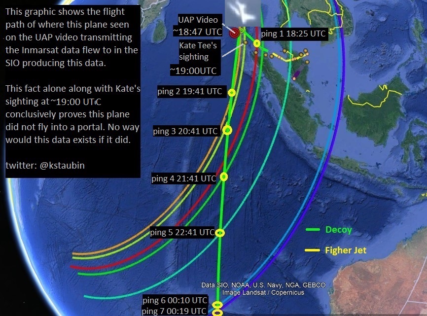
Possible flight path based on eye and ear witness reports.
Possible reverse drift pattern of the Flaperon piece on Reunion Island

Reverse drift pattern of the stabilizer piece in Mozambique (24 months). Note the red areas are the highest probability areas of where this piece may have originated from. The SIO search area is not even close possibility in this drift model.
http://adrift.org.au/backward?lat=-23.4&lng=35.9¢er=128.5&startmon=Jan

If both pieces in Reunion and Mozambique are from the same plane then reverse drift analysis on these pieces strongly suggest impact zone for MH370 was in NIO not SIO.

Here is another overlay image (below) of a reverse drift analysis done on both the flaperon piece (16 months) and the stabilizer piece (24 months) using the same tool adrift.org for both models.. You can clearly see that the highest probility for the impact zone of this plane, assuming both pieces are from the same aircraft, is in the NIO not SIO.

Here is a reverse drift analysis (below) done on the flaperon piece (16 months) using adrift.org. This model is consistent with the GEOMAR analysis showing highest probility area is in NIO.

Here is how a buoy was tracked in the Indian Ocean between JUL 2014 and SEP 2015. It shows how debris from this area may have drifted towards Reunion Island and Africa.

Here is where that woman (Raja) saw an aircraft like object floating in the water on March 8th,2014
Debris location
Location of this debris was determined by comparing cloud formations in the Tomnod images against the image map in the DigitalGlobe (DG) online database using the website Apollo Mapping which is a DG image reseller. Using this method I was able to determine the approxiamate location of these debris objects that were captured on March 16th, 2014 at 4:44UTC.


Link to Hi-Res image: https://www.dropbox.com/s/2hu14x7m946ndsb/MH370_Sumatra_debris_location_...
Ken S
Twitter @kstaubin


Comments
Post a Comment